


論文情報
著者:Ronald C. Estoque and Yuji Murayama
発表年:2017
掲載雑誌:ISPRS Journal of Photogrammetry and Remote Sensing 133: 18–29
論文へのリンク(英文のみ)
キーワード
Urban heat island; Land surface temperature; Remote sensing; Impervious surface; Green space; Baguio City
概要
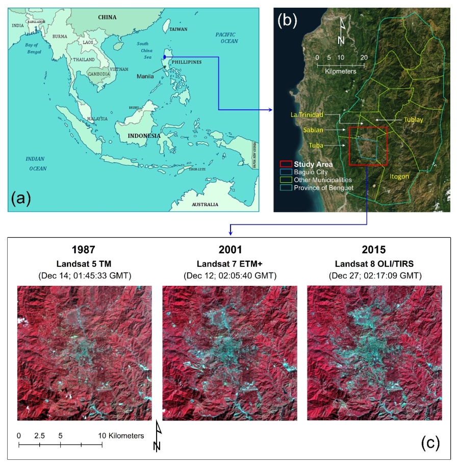
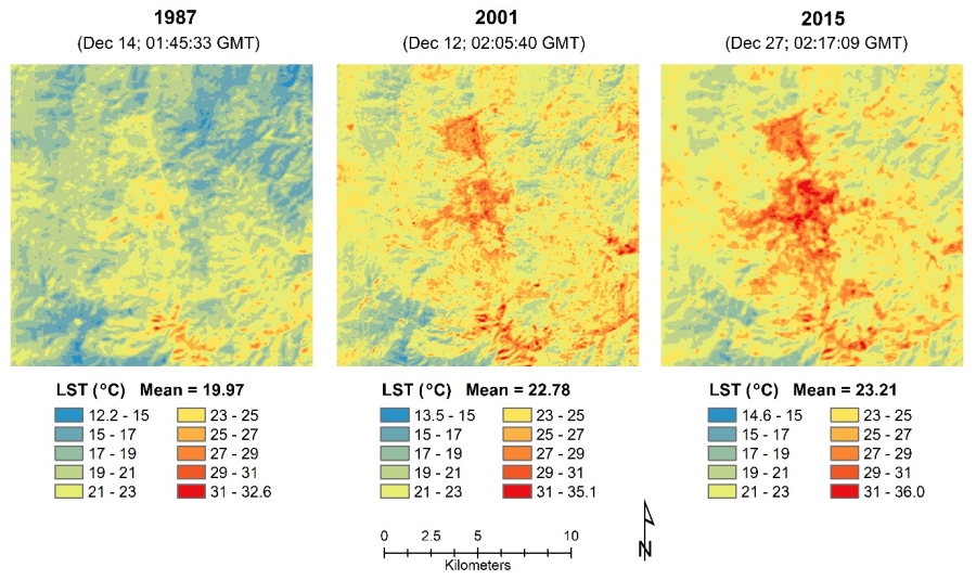
Since it was first described about two centuries ago and due to its adverse impacts on urban ecological environment and the overall livability of cities, the urban heat island (UHI) phenomenon has been, and still is, an important research topic across various fields of study. However, UHI studies on cities in mountain regions are still lacking. This study aims to contribute to this endeavor by monitoring and examining the formation of surface UHI (SUHI) in a tropical mountain city of Southeast Asia –Baguio City, the summer capital of the Philippines– using Landsat data (1987–2015). Based on mean surface temperature difference between impervious surface (IS) and green space (GS1), SUHI intensity (SUHII) in the study area increased from 2.7 oC in 1987 to 3.4 oC in 2015. Between an urban zone (>86% impervious) and a rural zone (<10% impervious) along the urban-rural gradient, it increased from 4.0 oC in 1987 to 8.2 oC in 2015. These results are consistent with the rapid urbanization of the area over the same period, which resulted in a rapid expansion of impervious surfaces and substantial loss of green spaces. Together with landscape composition variables (e.g. fraction of IS), topographic variables (e.g. hillshade) can help explain a significant amount of spatial variations in surface temperature in the area (R2 = 0.56–0.85) (p < 0.001). The relative importance of the ‘fraction of IS’ variable also increased, indicating that its unique explanatory and predictive power concerning the spatial variations of surface temperature increases as the city size becomes bigger and SUHI gets more intense. Overall, these results indicate that the cool temperature of the study area being situated in a mountain region did not hinder the formation of SUHI. Thus, the formation and effects of UHIs, including possible mitigation and adaptation measures, should be considered in landscape planning for the sustainable urban development of the area.