


Information of Paper
Authors:Hasegawa, T., Fujimori, S., Ito, A., Takahashi, K., Masui, T.
Year:2016
Information of Journal:Science of Total Environment.
Link to the paper
Abstracts
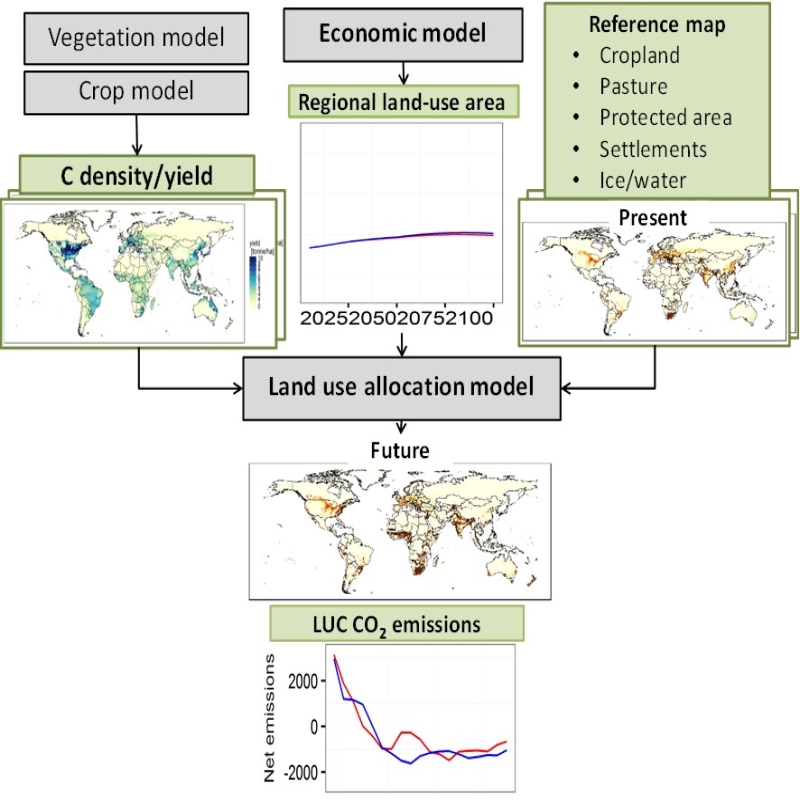
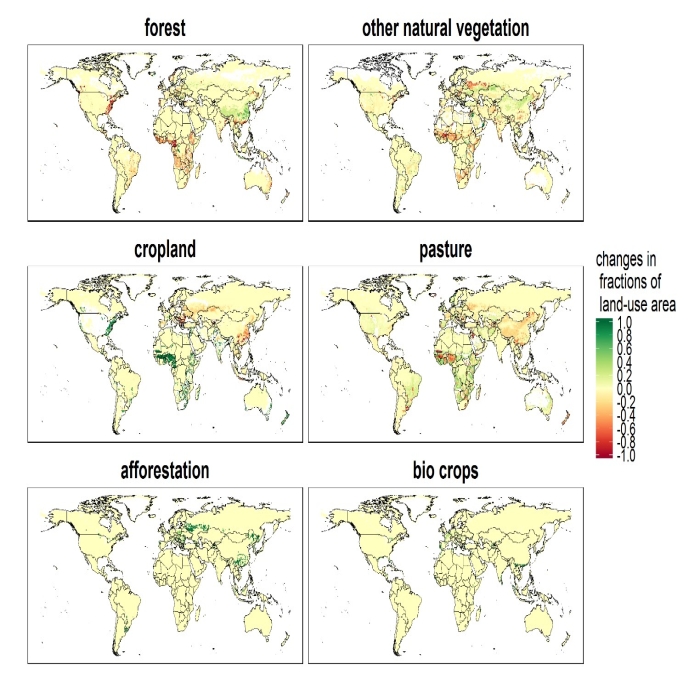
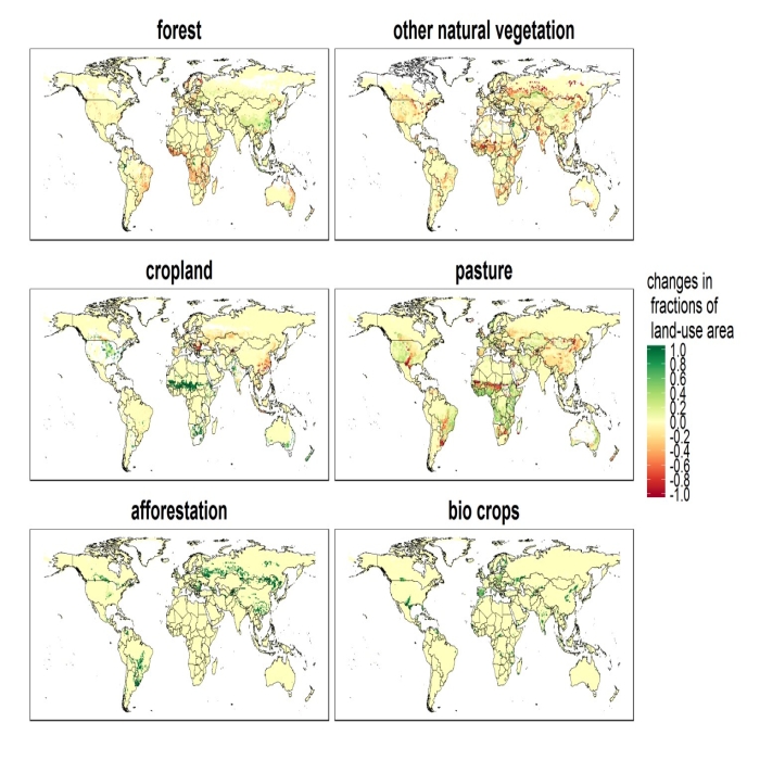
We developed a global land-use allocation model that can be linked to integrated assessment models (IAMs) with a coarser spatial resolution. Using the model, we performed a downscaling of the IAMs’ regional aggregated land-use projections to obtain a spatial land-use distribution, which could subsequently be used by Earth system models for global environmental assessments of ecosystem services, food security, and climate policies. Here we describe the land-use allocation model, discuss the verification of the downscaling technique, and explain the influences of the downscaling on estimates of land-use carbon emissions. A comparison of the emissions estimated with and without downscaling suggested that the land-use downscaling would help capture the spatial distribution of carbon stock density and regional heterogeneity of carbon emissions caused by cropland and pasture land expansion